Monday, June 25, 2012

WESTWARD AND THE INDIAN OCEAN

Dive site on the Great Barrier Reef

Over the past two weeks I have, for the most part, "day-sailed" up the East coast of Australia from Cairns to Thursday Island in the Torres Straits. Day-sailing is when you sail by day and anchor at night. Sailing inside the Great Barrier Reef is much more intricate than sailing in the open ocean. There is a very narrow shipping lane which threads it's way between the reefs and the mainland. At night one must navigate constantly and keep a lookout. This makes sleep out of the question. Some anchorages were 65 nm apart which necessitated a 0200 departure... all part of the adventure.

A giant anglefish


The anchorage at beautiful Hope Island

Morris Island


I departed Thursday Island  on June 17th  for the 680 nm sail  across the "top" of Australia. It is a mostly uninhabited coastline called Arnhem Land and all Aboriginal. I stopped for just one night on this leg to Darwin in the Wessel Islands at Two Island Bay... probably the most remote anchorage of the journey so far.

Downwind


I arrived in Darwin on the 22nd. I will re-provision here, top up on fuel and water and complete the departure formalities - then set a westerly course for Ashmore Reef and the Indian Ocean. It is 750 nm to Ashmore then 1600 nm to Cocos Keeling Island. I will bypass Christmas Island (also an Australian possession) as this where the "boat people" from Indonesia try to land and the Aussie's have their hands full.

By the way "nm" stands for nautical mile the length of which is 6076 feet. One degree of latitude is equal to 60 nm, so one minute of latitude equals one nm.

Internet will be even more difficult in the Indian Ocean but I will do my best to keep you updated.

Monday, May 21, 2012

CAIRNS


     I'm in Cairns (pronounced "cans") at the Marlin Marina right on the waterfront of town. Everything is great.. I was in the Whitsunday Islands for about a week. Nice sailing but the water isn't as clear as I'm used to (too many rivers). After I leave Cairns it will take about two weeks to get to the top of Australia (Torres Strait) and then I will be heading Westbound again. Darwin then the Indian Ocean.

Beautiful Hill Inlet in the Whitsunday Islands with
 Whitehaven Beach in the distance

The silica sand beach at Hill Inlet


Sunrise at Sawmill Beach

The entrance to Hardy Lagoon on the Great Barrier Reef

   
I'm including a photo of the GPS screen I took about 100 miles South of here. When the "targets" (cargo ships) get inside of 1/2 mile they turn red to indicate a possible conflict. If you look very closely the small red and green triangle in between the two is Flyer at 1am no less. Holy crap.

Saturday, May 12, 2012

On The Move... Northbound

 Flyer was ready to go back in the water on the 2nd of April. New zincs and rudder bushings were installed,
 the prop serviced and anti-fouling paint applied. She shouldn't need to come out of the water again for the remainder of the journey.
  
 I flew back to the States for my best friend's funeral. He was 61. He was on this earth for 22,783 days. You better make each one count.

I left Lake Macquarie on the 22nd, headed up the East coast of Australia. I'm now in the Whitsunday Islands on the Great Barrier Reef, where I'll spend the next several days exploring. Internet service is sketchy but I'll update when I can.


Some beautiful bays in the Southern Cumberland Islands

Thursday, February 23, 2012

THE REES-DART TRACK IN MAGNIFICENT MT. ASPIRING NATIONAL PARK

Drove to Queenstown for the next set of adventures. The Rees-Dart (after the rivers by the same name) Track was first. I decided to do the 37 miles in two days as the weather was forecast to turn rainy.

Hardly noticed me (I don't have a telephoto lens)

Beautiful walking in the alpine rainforest
Many waterfalls


Chamois, endemic to the European Alps were imported to NZ
in the early 1900's

This is looking straight down

Much like the PCT where some of the trail is carved (blasted) out of rock


As the weather was forecast to become rainy with low overcast I was going to miss the views in Fjordland so I decided to splurge and stand on a glacier as well...


Alfie also worked as a helicopter pilot filming
 Lord of The Rings


Birds eye of valley I had hiked the day before

Some snow time on the glacier


Mitre Peak in Milford Sound

You don't see this from the trail


I have just a bit more to do in NZ but the internet is always an issue so thanks for your patience.
Basking in the sunshine
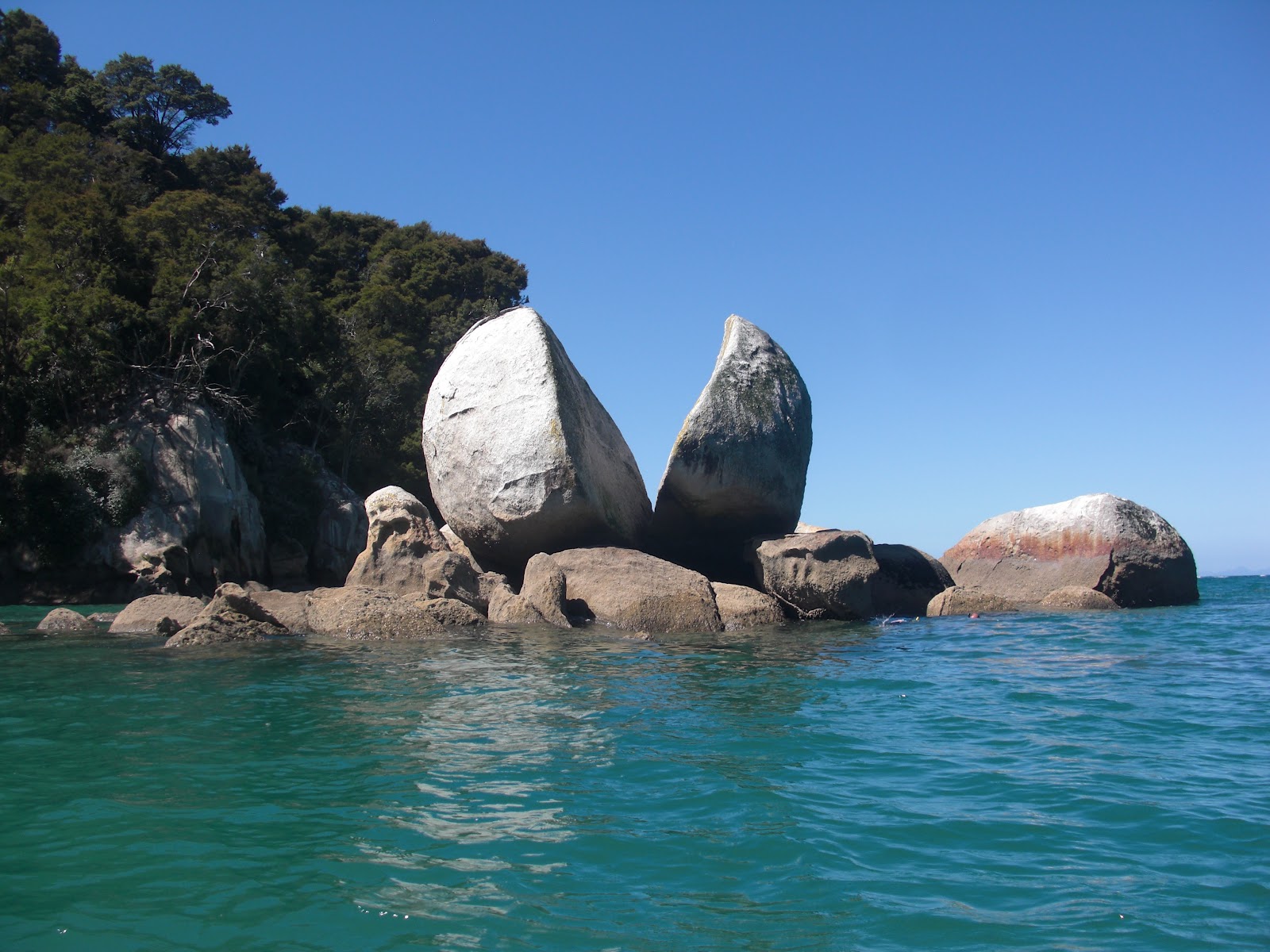
 Drove to Kaiteriteri on Tasman Bay for some sea kayaking in the Able Tasman National Park.


The sea kayak is a bit larger and has a steerable rudder

Lunch stop


A cracked dinosaur egg
 
On to Arthur's Pass National Park to walk the Narnia Track, where the movie by the same name was filmed. Then to Mt.Cook National Park to see New Zealand's highest point.
View of Mt. Cook hiking up the Hooker Valley

THE SOUTH ISLAND...

After the Whanganui River I drove to Wellington for the ferry across the Cook Straight to Picton. Next on the list was the Queen Charlotte Track. You take a mailboat to water acess only Ship Cove where famous English explorer Captain James Cook anchored five times in the late 1770's. The walk starts here and for 44 miles follows the ridges above the Queen Charlotte, Marlborough and Keneperu Sounds.


Ferry "ARATERE" from Wellington to Picton
First nights stay at Punga Cove
Grandfather said, "Stop and smell the roses"
Very much like Puget Sound
On to the Whanganui River for a three day , 54-mile paddle of a nearly unbroken gorge of sheer cliff walls. Most do the trip in canoes but as I was solo a kayak was my transport. I paddled alone mostly and only saw people at the huts overnight.
Looks a bit like a toy boat


Relaxing after the journey