Tuesday, December 11, 2012

THE ROOF OF AFRICA


At 5895 meters (19,341 ft.), Kilimanjaro is the highest free -standing mountain in the world (no other mountains around it like Mt. Hood and Mt. Rainier). It requires no technical skills to climb (crampons, ice axes, ropes etc.) but there is some class 3 scrambling and the effects of altitude are significant. Colleen and my good friend Steve Jackson flew from the States to join me on the climb. We had 2 guides, a cook, a waiter and 8 porters.  It was like a mini expedition and gave you an idea, on a much smaller scale, of what an Everest climb would be like. The route was 6 days and with the exception of summit day, we hiked/climbed 6 to 7 hours a day. Summit day started at midnight. We reached the summit at 0730 and got back to base camp at 1030. We then packed up, ate lunch and hiked down another 5 hours to our camp for the last night.


The moon was so bright we were able to climb without headlights


After Kilimanjaro we drove to the Ngorongoro Crater for some game viewing, the highlight of which was a lion pride / buffalo herd standoff.


Cape Town is considered to be one of the most beautiful
cities in the world


I will spend the holidays in Cape Town and then depart for St. Helena after the 1st of the year.  

Saturday, October 27, 2012

CAPE TOWN


The trip down the East coast of Africa is a challenging one.  Richards Bay to Durban is 100nm and is an  overnight sail. This is not too difficult as one only needs a 24hr window of favorable weather.  The next leg, Durban to East London, is the most difficult as it is 250nm with absolutely no safe harbors in between. A favorable forecast of at least 3 days is imperative. Since the forecasts are only accurate for 3 days, at the most, there is an element of chance involved.  The Agulhas current can reach 6 knots near East London and with any southerly wind over 15 knots, conditions can become dangerous very quickly. As luck would have it, there was a 3 day forecast for light winds 4 days after reaching Durban so I made use of it. The conventional  wisdom is, “if you get a window you must not hesitate”.  During the trip I had only 6 hours of southerly wind @ 12-15 knots but even that made the seas very rough. I don’t even want to think about what it would be like in 30 knots. I received another forecast on the satellite phone enroute and decided to continue past East London to Port Elizabeth. I was there for only 12 hours and decided to keep moving toward Cape Town. The Agulhas current had now spread out across the Agulhas Bank and is no longer a factor. Now all I had to worry about was the infamous ”Cape of Storms” Cape Agulhas itself. Port Elizabeth to Mossel Bay was not too bad save the last 8 hours. With only the smallest mainsail set, the knotmeter (an instrument that measures the boats actual speed through the water), not the GPS, read 10.2 knots… pretty wild. Mossel Bay port control reported 40 knots +.  After 4 very rolly days at the yacht club marina I received a forecast with a 24 hour window of light winds at the Cape. Again I decided to give it a go. At 1057 local time on the 22nd of October I passed Cape Agulhas and from the Indian Ocean into the Atlantic. I was able to make a 30 degree right turn and for the first time since leaving Thursday Island at the top of Australia, the wind, current, waves and swell were all behind me. The remainder of the sail up the West coast was very pleasant and  took me past The Cape of Good Hope.  There is a funneling effect of the SE wind off Table Mountain and into Table Bay which is why one should plan a dawn arrival as it should be much calmer. Not for my dawn arrival. If someone would have told me that the highest winds to date for the entire circumnavigation would be inside the breakwater in Cape Town, I would have said, have another drink pal… 47 gusts to 55!! Holy crap.
I am snug in the V&A (Victoria & Alfred) Waterfront Marina right in the middle of Cape Town.. Awesome.


P.S. Most of the other cruisers are stuck in Richards Bay waiting for weather.

Thursday, October 4, 2012

IMFOLOZI

I was lucky enough to meet Eric, an avid hunter at the yacht club, who offered to guide us (Risto and Helina, my Finnish friends and I) on a game drive in the Imfolozi Game Park. It is Africa's oldest game park and has the largest population of white Rhino in the world.

The dung beetle is a curious creature. I'm not sure how he sees where he's going.

The impala is the mainstay of the lion and leopards diet 


Not altogether happy with our presence  


"I am smiling"


Friday, September 28, 2012

THE LAST CONTINENT

My good friends from Reunion


10 days, 10 hours and 58 minutes is what it took to sail from St. Pierre to Richards Bay, South Africa... 1392 nm. This was the most challenging leg of the voyage so far. Usually when sailing in trade winds one is not concerned about the weather (provided you don't sail during cyclone season). This leg is different because the Agulhas Current must be crossed. It runs just off the coast of South Africa and averages a speed of 3-4 knots. About every three days a weather system called a "southerly buster" moves up the East coast of SA bringing southwesterly winds. These are many times gale force (30-40kts). This wind against current produces more abnormally high and "freak wave" conditions than any place else in the world. The trick is to cross the current with NE winds. This becomes problematic on a ten day passage because the weather forecasts are only accurate for 3 days. As luck would have it I had a small window (4 hours) to reach Richards Bay before a southerly wind arrived. The night before crossing I had winds of 35 knots with gusts of 40+. Its interesting that the highest winds of the journey so far have been on September 26th 2011 and 2012.

Sunday, September 16, 2012

GRAND BASSIN


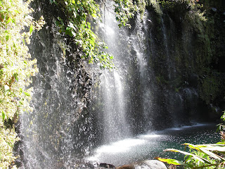
A last set of pictures before I set sail for South Africa. Grand Bassin is a tiny village at the bottom of a 2500 foot ravine. Very near the village is a small lake fed by a waterfall. One must work their way along a vertical wall of rock with very few hand holds to reach it.. Magnifique, as the French would say.


Thursday, September 6, 2012

TOUR DE LA REUNION


Looking up the Ravine du Mat toward Hell-Bourg.


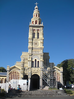
The beautiful chapel in St. Philippe


What could be better than sorbet and beer?


I found a cycle shop that rented bikes so I thought I would see some more of the island. The bike was a one year old Trek "Madone" all carbon, about 4000 euros new, for 15 euros/day. I liked the town of Hell - Bourg where I had stayed during the hike so I decided to ride back. The next day I returned to St, Pierre by way of the southern coastline. 140 miles, mostly up and down was well worth my sore sit bones.

THE THREE CIRQUES

One of the reasons I came to Reunion is because I heard the hiking was very good. "Very good", doesn't begin to describe it. Basically the island was one big volcano whose interior collapsed millions of years ago, forming three cirques... Cilaos, Mafate and Salazie with Piton des Neige, the highest point in the Indian Ocean, in the middle. My hike took me to all three cirques and to the top of Piton des Neige.

The chapel in Cilaos


The trail is cut into the solid rock


The beginning of a 7500' climb

This is meters...each 305 meters is = 1000 feet.

The top of Piton des Neige.. just over 10,000 feet


Sunday, August 26, 2012

SAINT PIERRE, REUNION IS.


Believe it or not this is the entrance to St Pierre harbor. Not for the faint of heart. I'm off to hike the interior of the island this week... I'll take lots of pictures.

Wednesday, August 15, 2012

REUNION IS. - SOUTH AFRICA NEXT


Ever wonder how a palm tree starts?
It was 1500 nm from Ashmore reef to Cocos Keeling Is., a beautiful atoll in the middle of the Indian Ocean. After a few days at the anchorage off Direction Is. it was back to sea for the 1982 nm sail to Rodrigues Is. 13 days and 5 hours later I was there. During this leg Flyer had her third best day ever... 177 nm. Mauritius was next, only a 2 day sail.
Mauritius is a mountainous island so I decided to go climbing. Next time I'll choose the peak with a trail to the top.


Reunion was an overnight sail from Mauritius. Even more mountainous than Mauritius, Reunion has mankilometers of trail which I am looking forward to. All for now.. 


Monday, June 25, 2012

WESTWARD AND THE INDIAN OCEAN

Dive site on the Great Barrier Reef

Over the past two weeks I have, for the most part, "day-sailed" up the East coast of Australia from Cairns to Thursday Island in the Torres Straits. Day-sailing is when you sail by day and anchor at night. Sailing inside the Great Barrier Reef is much more intricate than sailing in the open ocean. There is a very narrow shipping lane which threads it's way between the reefs and the mainland. At night one must navigate constantly and keep a lookout. This makes sleep out of the question. Some anchorages were 65 nm apart which necessitated a 0200 departure... all part of the adventure.

A giant anglefish


The anchorage at beautiful Hope Island

Morris Island


I departed Thursday Island  on June 17th  for the 680 nm sail  across the "top" of Australia. It is a mostly uninhabited coastline called Arnhem Land and all Aboriginal. I stopped for just one night on this leg to Darwin in the Wessel Islands at Two Island Bay... probably the most remote anchorage of the journey so far.

Downwind


I arrived in Darwin on the 22nd. I will re-provision here, top up on fuel and water and complete the departure formalities - then set a westerly course for Ashmore Reef and the Indian Ocean. It is 750 nm to Ashmore then 1600 nm to Cocos Keeling Island. I will bypass Christmas Island (also an Australian possession) as this where the "boat people" from Indonesia try to land and the Aussie's have their hands full.

By the way "nm" stands for nautical mile the length of which is 6076 feet. One degree of latitude is equal to 60 nm, so one minute of latitude equals one nm.

Internet will be even more difficult in the Indian Ocean but I will do my best to keep you updated.

Monday, May 21, 2012

CAIRNS


     I'm in Cairns (pronounced "cans") at the Marlin Marina right on the waterfront of town. Everything is great.. I was in the Whitsunday Islands for about a week. Nice sailing but the water isn't as clear as I'm used to (too many rivers). After I leave Cairns it will take about two weeks to get to the top of Australia (Torres Strait) and then I will be heading Westbound again. Darwin then the Indian Ocean.

Beautiful Hill Inlet in the Whitsunday Islands with
 Whitehaven Beach in the distance

The silica sand beach at Hill Inlet


Sunrise at Sawmill Beach

The entrance to Hardy Lagoon on the Great Barrier Reef

   
I'm including a photo of the GPS screen I took about 100 miles South of here. When the "targets" (cargo ships) get inside of 1/2 mile they turn red to indicate a possible conflict. If you look very closely the small red and green triangle in between the two is Flyer at 1am no less. Holy crap.